
Utilizing Open-Source GIS and Multi-Criteria Decision Analysis for Onion Cold Storage Site Selection in Nueva Vizcaya, Philippines
Article Sidebar
Main Article Content
Abstract
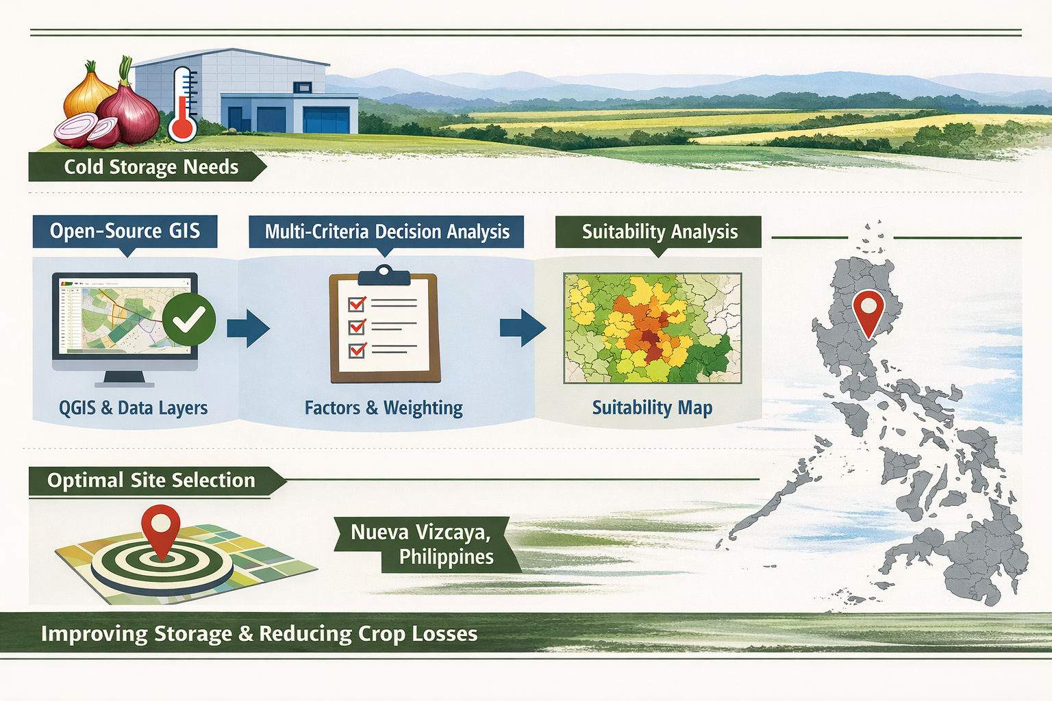
Onion is an important agricultural commodity in the Philippines, and it provides livelihood to the farmers and contributes to food security in the country. Despite its observed increase in production, challenges remain in terms of postharvest management, particularly due to inadequate storage. This study aimed to locate suitable sites for cold storage infrastructure in the province of Nueva Vizcaya using Geographic Information System (GIS) and Multi-Criteria Decision Analysis (MCDA). Spatial data such as land cover, road network, onion production area, and agricultural markets were used for weighted overlay analysis through Quantum GIS (QGIS). The findings showed that approximately 43.84% (171,997 ha) of the total area of the province is suitable for cold storage of onions, with a large extent of areas in the municipalities of Kayapa, Aritao, Santa Fe, and Bambang. The applicability of the model was demonstrated by the spatial analysis that verified the proposed onion cold storage location in Aritao was in an appropriate location. This exhibited the capability and importance of using an open-source GIS for siting postharvest facilities. It is suggested for future studies to incorporate parameters including socioeconomic indicators, facility capacity, and logistical costs to enhance future investments in agricultural infrastructure.
Article Details

This work is licensed under a Creative Commons Attribution-NonCommercial-NoDerivatives 4.0 International License.
References
Department of Agriculture - High Value Crops Development Program. Philippine Onion Industry Roadmap 2021–2025 [Internet]. Quezon City (PH): Department of Agriculture and UPLB Foundation Inc.; 2022 [cited 2025 Apr 11]. Available from https://pcaf.da.gov.ph/index.php/cir-onion/
Philippine Statistics Authority. OpenSTAT: A platform for Philippine statistics [Internet]. Quezon City (PH): Philippine Statistics Authority; [cited 2025 Apr 11]. Available from: https://openstat.psa.gov.ph/
Supangco EE. Analysis of the supply trend and response of onion in the Ilocos and Central Luzon regions in the Philippines, 1991–2014. J Int Trade Commer. 2016;12(2):1–4.
Food and Agriculture Organization of the United Nations. FAOSTAT: Crops and livestock products [Internet]. Rome: FAO; 2024 [cited 2025 Apr 10]. Available from: https://www.fao.org/faostat/en/#data/QCL
Calica GB, Cabanayan ZLL. Assessment of the postharvest systems and losses of bulb onions in Nueva Ecija, Philippines. Asian J Postharvest Mech. 2018;1(1):47–55.
Department of Agriculture - High Value Crops Development Program (DA-HVCDP). Onion farmers hit it big with off season production [Internet]. 2022 Nov 15 [cited 2025 Apr 10]. Available from: https://hvcdp.da.gov.ph/2022/11/15/onion-farmers-hit-it-big-with-off-season-production/
Ray SS, Kundu N, Dutta S, Panigrahy S. A GIS and remote sensing based approach for siting cold storage infrastructure for horticultural crops: A case study for potato crop in Bardhaman District, West Bengal, India. J Indian Soc Remote Sens. 2000;28(3):171–8.
Abhinav A, Chethan VA, Pancholi S, Mohan PD, Rayyan SM, Pandey K. GIS based infrastructure planning of cold storages for crop preservation: A case study of Kolar District, Karnataka. Spatial Inf Res. 2022;30(4):489–95.
Upadhyay G, Bhattacharya BK. Site suitability for developing new cold chain using multi-criteria decision analysis and geospatial techniques. Int Arch Photogramm Remote Sens Spatial Inf Sci. 2019;42(3/W6):325–9.
Ray SS, Dutta S, Kundu N, Panigrahy S. Optimisation of potato cold storage location using remote sensing and GIS. Remote Sens Hortic. 2010;108:193–201.
Vijjapu P, Kimothi MM, Roy S, Mamatha S, Ray SS. Geospatial perspective for post-harvest infrastructure management: positioning of new cold storage. Int Arch Photogramm Remote Sens Spatial Inf Sci. 2019;42(3/W6):339–44.
Chaudhuri A, Dukovska-Popovska I, Subramanian N, Chan HK, Bai R. Decision-making in cold chain logistics using data analytics: a literature review. Int J Logist Manag. 2018;29(3):839–61.
Nath S, Chakrabarti B. Political economy of cold storages in West Bengal. Commodity Vis. 2011;4(4):36–42.
Krishnaveni M, Kowsalya M. Mapping and analyses of post harvesting supply chain entities of mango using GIS: A case study for Krishnagiri District, Tamil Nadu, India. Int J Sci Res Sci Technol. 2019;8(2):2046–52.
National Mapping and Resource Information Authority (NAMRIA), Philippine Statistics Authority (PSA). Philippines administrative level 0–4 boundaries [Internet]. OCHA Philippines; 2022 [cited 2022 Mar 19]. Available from: https://data.humdata.org/dataset/cod-ab-phl
Gavino Jr JT, Ramos EE, Alberto RT. Site suitability mapping of onion in the province of Occidental Mindoro using Geographic Information System (GIS) Model Builder. Sci Asia Rev. 2020;2(1):45–52.
Cagasan U. Comparative assessment on the research managed and farmer managed onion production in Sto. Domingo, Nueva Ecija, Philippines. Eurasian J Agric Res. 2020 Nov 11;4(2):81-91.
Declaro-Ruedas MYA, Ruedas EG. Optimizing agricultural sustainability: integrating solar-powered drip irrigation in the onion-corn cropping system for climate-resilient farming in Magsaysay, Occidental Mindoro. Disc Agric Food Sci. 2024;12(6):77–88.
Villaroman CJ, Espino A Jr, Lavarias J, Taylan V. Atmometer-based irrigation scheduling system for drip-irrigated onion (Allium cepa L.). MATEC Web Conf. 2018;192:03039.
CGIAR Consortium for Spatial Information (CGIAR-CSI). Philippines elevation model [Internet]. British Red Cross Maps Team; 2016 [cited 2022 Mar 19]. Available from: https://data.humdata.org/dataset/philippines-elevation-model
Fick SE, Hijmans RJ. WorldClim 2: new 1‐km spatial resolution climate surfaces for global land areas. Int J Climatol. 2017;37(12):4302–15.
PhilGIS. General Soil Classes [Internet]. [cited 2022 Mar 19]. Available from: https://drive.google.com/file/d/0B8qrCcaQIB4zc0IyTUV5aE9aNzQ/view?usp=sharing
PhilGIS. Land Cover [Internet]. 2004–2007 [cited 2022 Mar 19]. Available from: https://drive.google.com/file/d/0B8qrCcaQIB4zRzNnMFFCaXJMcUU/view?usp=sharing
OpenStreetMap contributors. Road network [Internet]. 2024 [cited 2022 Mar 19]. Available from: https://download.geofabrik.de/asia/philippines-latest-free.shp.zip
Bureau of Agricultural and Fisheries Engineering (BAFE). Geographic Information System for Agricultural and Fisheries Machinery and Infrastructure (GEOAGRI) [Internet]. 2024 [cited 2025 Apr 10]. Available from: https://geoagri.bafe.gov.ph/iroadmap/
Department of Agriculture Regional Field Office II (DA-RFO II). Onion production area shapefiles for Aritao, Nueva Vizcaya: DA-RFO II; 2022.
GeoRisk Philippines. HazardHunterPH [Internet]. Quezon City (PH): GeoRiskPH; [cited 2025 Apr 10]. Available from: https://hazardhunter.georisk.gov.ph/
QGIS Association. QGIS Geographic Information System. QGIS Association; [cited 2022 Mar 19]. Available from: https://download.qgis.org/downloads/
Tveite H. Multi-distance buffer QGIS plugin. QGIS Association; [cited 2022 Mar 19]. Available from: https://plugins.qgis.org/plugins/MultiDistanceBuffer/
QGIS Development Team. QGIS User Manual Version 3.22 [Internet]. [cited 2022 Mar 19]. Available from: https://docs.qgis.org/3.22/en/docs/user_manual
Amongo RM, Saludes R, Gallegos RK, Relativo PL, Duminding RS, Pantano AD, Cunan JJ, Lalap-Borja GN. A GIS-based land suitability model for agricultural tractors in CALABARZON Region, Philippines. Sci Rep. 2023 Oct 25;13(1):18272.
Jayasinghe LS, Kumar L, Sandamali J. Assessment of potential land suitability for tea (Camellia sinensis (L.) O. Kuntze) in Sri Lanka using a GIS-based multi-criteria approach. Agriculture. 2019;9(7):148.
Singh AK, Subramanian N, Pawar KS, Bai R. Cold chain configuration design: location-allocation decision-making using coordination, value deterioration, and big data approximation. Ann Oper Res. 2018 Nov;270:433–57.
Huang Q, Zheng G, Pan S, Liao H, Jiang Z. Layout optimization of multi-level cold chain storage facilities in agricultural producing areas considering type and capacity constraints. PLoS One. 2025 Feb 11;20(2):e0313062.
de Lima RM, Osis R, de Queiroz AR, Santos AH. Least‐cost path analysis and multi‐criteria assessment for routing electricity transmission lines. IET Gener Transm Distrib. 2016 Dec;10(16):4222–30.
