
ระบบสารสนเทศเพื่อสนับสนุนการเฝ้าระวังและเตือนภัยธรรมชาติแบบมีส่วนร่วม จังหวัดอุตรดิตถ์
Article Sidebar
Main Article Content
บทคัดย่อ
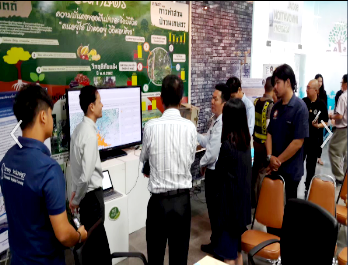
งานวิจัยนี้มีวัตถุประสงค์เพื่อพัฒนาระบบสารสนเทศเพื่อสนับสนุนการเฝ้าระวังและเตือนภัยธรรมชาติ จังหวัดอุตรดิตถ์ กระบวนการวิจัยเป็นการทำงานร่วมกันระหว่างภาควิชาการ สำนักงานป้องกันและบรรเทาสาธารณภัยจังหวัดอุตรดิตถ์ และ UTT TEAM โดยระบบสารสนเทศที่พัฒนาสามารถใช้สำหรับการเฝ้าระวังและเตือนภัยธรรมชาติ 3 ประเภท คือ 1) อุทกภัย 2) แผ่นดินถล่ม และ 3) ไฟป่า การวิเคราะห์ความเสี่ยงของการเกิดภัยธรรมชาติมาจากการใช้ฐานข้อมูลภูมิสารสนเทศกลางที่มีข้อมูลสภาพภูมิประเทศ สภาพภูมิอากาศ และข้อมูลย้อนหลัง 10 ปี จากหน่วยงานที่เกี่ยวข้อง รวมทั้งข้อมูลอัตโนมัติแบบตามเวลาจริงจากเครื่องมือ 3 ชิ้น ที่พัฒนา คือ 1) เครื่องตรวจวัดสภาพแวดล้อม 2) เครื่องตรวจวัดปริมาณน้ำท่าในลุ่มน้ำย่อย และ 3) เครื่องมือรังวัดและเตือนภัยแผ่นดินถล่ม การทำงานของระบบสารสนเทศสามารถวิเคราะห์และประเมินสถานการณ์สาธารณภัยขั้นต้นให้กับสำนักงานป้องกันและบรรเทาสาธารณภัยจังหวัดอุตรดิตถ์ โดยประมวลผลข้อมูลการเตือนภัยต่าง ๆ ดังนี้ 1) การเตือนภัยอุทกภัย จากข้อมูลปริมาณความสูงของระดับน้ำท่าในลุ่มน้ำย่อยซึ่งส่งมาทุก 5 นาที 2) การเตือนภัยแผ่นดินถล่ม จากข้อมูลระดับความลาดชันซึ่งส่งมาทุกสัปดาห์ และ 3) การเตือนภัยไฟป่า จากข้อมูลจุดความร้อนซึ่งส่งมาทุก 3 ชั่วโมง ทำให้สำนักงานป้องกันและบรรเทาสาธารณภัยจังหวัดอุตรดิตถ์และ UTT TEAM สามารถติดตามสถานการณ์และเตือนภัยธรรมชาติได้รวดเร็วและมีประสิทธิภาพ
Article Details

อนุญาตภายใต้เงื่อนไข Creative Commons Attribution-NonCommercial-NoDerivatives 4.0 International License.
Area Based Development Research Journal values copyright protection and licensing to safeguard author rights and facilitate the appropriate dissemination of research. Our policies ensure openness, accessibility, and attribution. Authors retain copyright ownership, and articles are published under a Creative Commons Attribution License (CC BY), allowing sharing, adaptation, and proper attribution. Authors have the freedom to publish under the CC BY license, granting broad reuse and distribution permissions. The journal supports posting articles on third-party repositories, adhering to institutional and funding restrictions. Author guidelines detail copyright and licensing requirements, empowering authors with knowledge about their rights and responsibilities. These policies cultivate an environment of collaboration, openness, and responsible sharing, benefiting authors and the research community while honoring intellectual property rights.
เอกสารอ้างอิง
Boonklong, O. (2018). Application of mathematical model in landslide risk assessment from waterflood and flash: A case study of Nopphitam district, Nakhon Si Thammarat province. Wichcha Journal Nakhon Si Thammarat Rajabhat University, 37(1), 1-11. (in Thai).
Boonprong, S., Cho, C,. Torteeka, P., Boonpook, W., & Sukawattsnavijit, C. (2018). The classification of burnt forest area by Landsat 5 TM data using CANFET. Journal of Remote Sensing and GIS Association of Thailand, 19(4), 154-166. (in Thai).
Department of Mineral Resource. (2013). Landslide risk map at community level. Retrieved February 3, 2020, from http://www.dmr.go.th/download/map57/utharadit.pdf. (in Thai).
Department of Prevention and Mitigation. (2020). 30 years “drought-flood”. Retrieved March 4, 2020, from https://thaipublica.org/2020/02/statistics-of-drought-flood-30-years/. (in Thai).
Healthinfo. (2013). Thailand in situations natural disaster. Retrieved February 25, 2020, from https://www.hiso.or.th/hiso/picture/reportHealth/ThaiHealth2013/thai2013_15.pdf. (in Thai).
Inruang, W., & Chaipimonplin, T. (2015). The prediction of landslides risk areas in Uttaradit province by applying geo-informatics technology with an artificial neural network. Journal of Social Sciences Srinakharinwirot University, 18(1), 191-207. (in Thai).
National Statistical office. (2013). Summary of flood impact data And establishments, commercial businesses and service businesses. Retrieved March 3, 2020, from https://www.ryt9.com/s/nso/1639475. (in Thai).
Ngao, K., Suwa, A., Suwa, A., & Thongsuk S. (2016). An implementation of agriculture environment sensors system and monitor via smart phone. Journal of Project in Computer Science and Information Technology, 2(1), 60-66. (in Thai).
Office of Natural Resources and Environmental Policy and Planning. (2017). Database for situation reporting environmental quality in Thailand. Retrieved February 2, 2020, from http://www.onep.go.th/env_data/2016/01_77/. (in Thai).
Office of Uttaradit Provincial Disaster Prevention and Mitigation. (2020). Disaster prevention and mitigation plan for colds Uttaradit. Uttaradit, Thailand. (in Thai).
Pantuna, N., Datdacha, S., & Rawicha, C. (2012). Novel water level sensing for the canals in Bangkok. RMUTP Research Journal, 6(1), 169-179. (in Thai).
Ruangsiriwattanakul, C. (2019). The development of prototype equipment for information system of environmental monitoring and production factor in agroforestry area, Uttaradit, Thailand. Applied Mechanics and Materials, 886, 233-239.
Srisang, P., Katathikarnkul, S., & Mani, M. (2014). Water level gauge to transmit data using wireless sensor networks. Thaksin University Journal, 17(3), 51-59. (in Thai).
Suksabai, K., & Nakhapakorn, K. (2014). Fire detection using LANDSAT thermal data: In SaiYok district, Kanchanaburi province, Thailand. Thai Science and Technology Journal, 22(4), 462-473. (in Thai).
Suk-ueng, K., Phrommarat, B., Nanglae, S., Changruenngam, T., & Sudsanit, S. (2017). Mapping of landslide susceptibility area using geographic information system and logi. Veridian E-Journal Science and Technology Silpakorn University, 4(6), 1-10. (in Thai).
Suteerasak, T., & Tohwanlong, W. (2016). Application of basic mathematics to the studying of hillside slope and soil surface of landslide area: A Case study of Phuket province. KMUTT Research and Development Journal, 39(4), 439-510. (in Thai).
Thammathiwat, A., Thipwong, S., Pangsai, N., & Ongoad, N. (2015). The construction of disaster warning and monitoring system of Phetchabun province. Proceeding of National Academic Conference No. 2 “Research for Local Development”, (p.83-88). Phetchabun Rajabhat University, Phetchabun. (in Thai).
